

|
|
Thursday June 23rd 2016, day one of two back to back days of storm potential for N. Ireland. GFS indicated 600-700 surface based CAPE with cold air aloft and decent humidity while soundings supported the formation of low cloud bases. Good solar heating early in the day would develop showers and thunderstorms however local convergence zones and 30 knots of 0-6km speed shear meant a few storms would be organised with hail up to 1.5cm in diameter with a risk of funnel clouds and weak tornadoes. This was the first set-up in quite some time where wind shear was present so I was quite excited by the synoptics and was anticipating something decent to happen, however the question was where?. I feel like I have spent most of the 2016 storm season chasing miles from home in other counties however the recent night time lightning storm and daytime high based rumblers I got in my home vicinity had gave me the thirst for more storms near home. I wanted to save diesel and energy and once more it looked like the storms were going to come to me this time, models indicated several possible locations in the mid-Ulster area from Tyrone to the Sperrins, including my home town of Maghera then Lough Neagh and parts of Antrim, these areas I suspected could produce the goods.
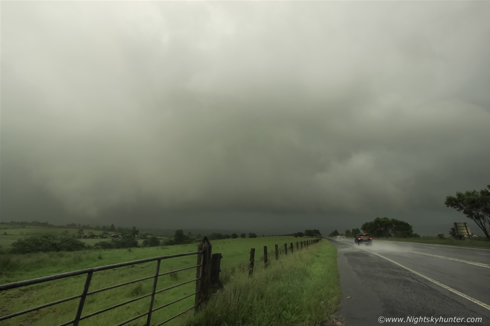
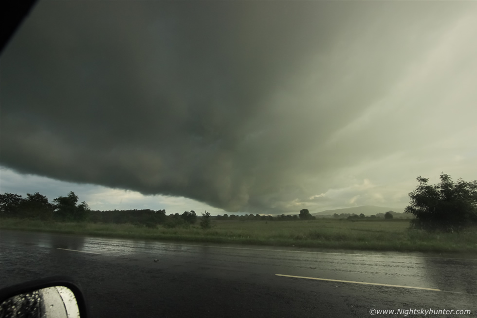
The day began warm and sunny with plenty of solar heating and it was clear from building activity on radar that heavy showers were already building over the far W and SW of the country and their slow movement meant they would be carried straight into my target zone on the SWly flow by afternoon heating time. By mid afternoon the sky began to cloud cover ahead of this advancing trough of showers then once it crossed the border into N. Ireland they began to rapidly intensify to the point where I could no longer sit idle and simply had to make a move. A line of strong cells were arranged in a N-S line while moving NE and so long it was already covering three counties in length almost taking on squall line qualities, the line was slow moving and inching forward, the northern end of which looked to be nearing Maghera however the strongest radar signature was coming from the southern side of the line which was located over western Tyrone so I decided to give chase and target that area, my plan was to hit Cookstown and make adjustments after that, however my main goal was to get eyes on the skies for there could be a nice shelf cloud or gust front forming.
My Mum came along with me for the adventure so we raced out the roads as swiftly as possible then once outside Desertmartin I changed my plan. I could see the leading edge of the line and it looked much more photogenic so I decided to change course and pursue the northern end instead so we took the back roads to get further W and N dodging tractors and other unexpected hazards on the narrow country roads then emerged at Tobermore where we pulled along side the Church and got out for a look. Beyond the graveyard and headstones was a dramatic sky, a huge line of clouds extended from our position all the way back to the SW for miles, the clouds were heavy and bloated with bands of silvery rain curtains breaking out from the dark belly and falling over the tops of the Sperrins, the line looked young and strong, we watched for 20 min's then decided to change location because it was almost on us and I needed a more photogenic foreground for shooting so I decided to get ahead of it and try out Maghera itself.
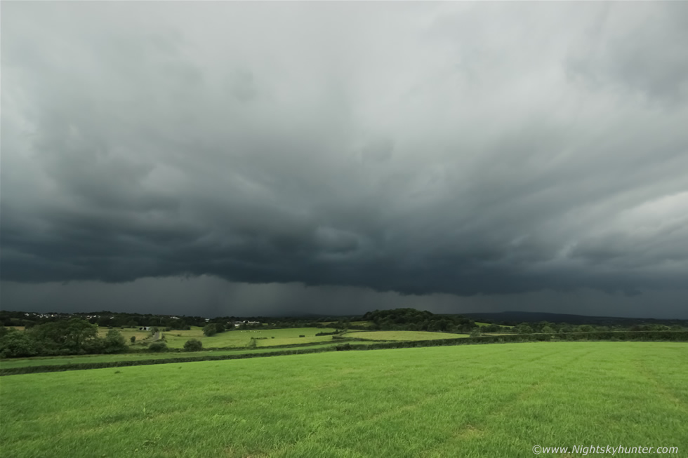 |
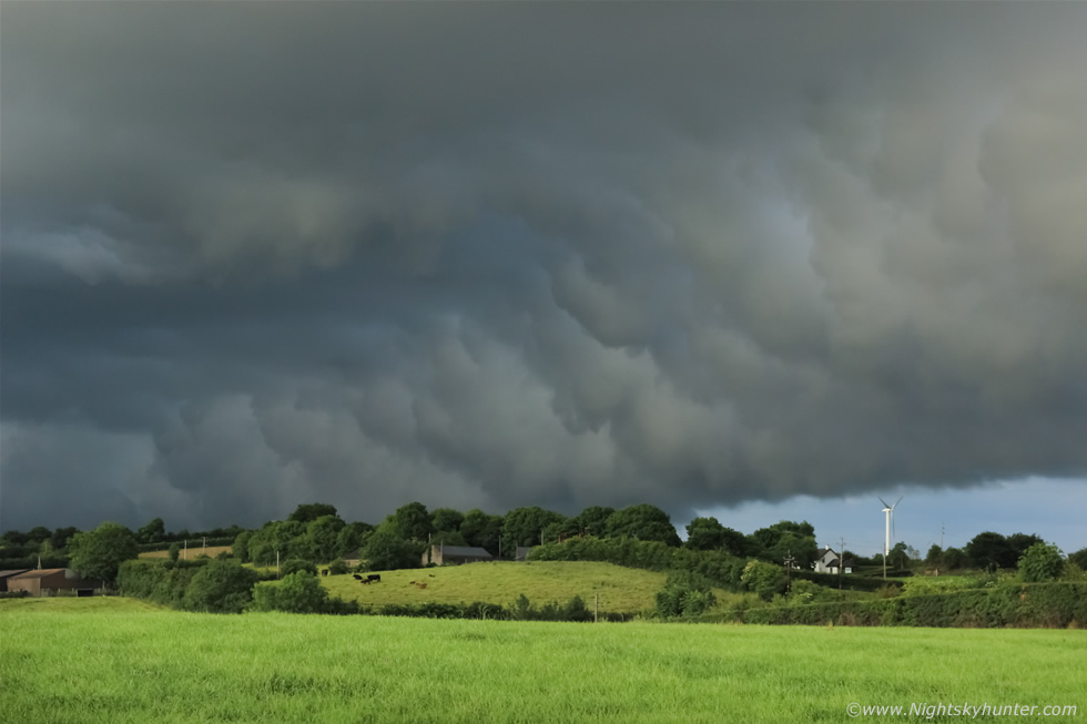
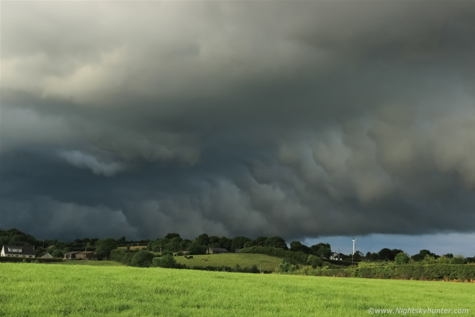
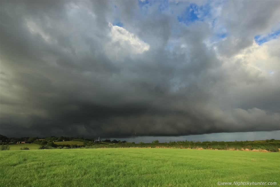
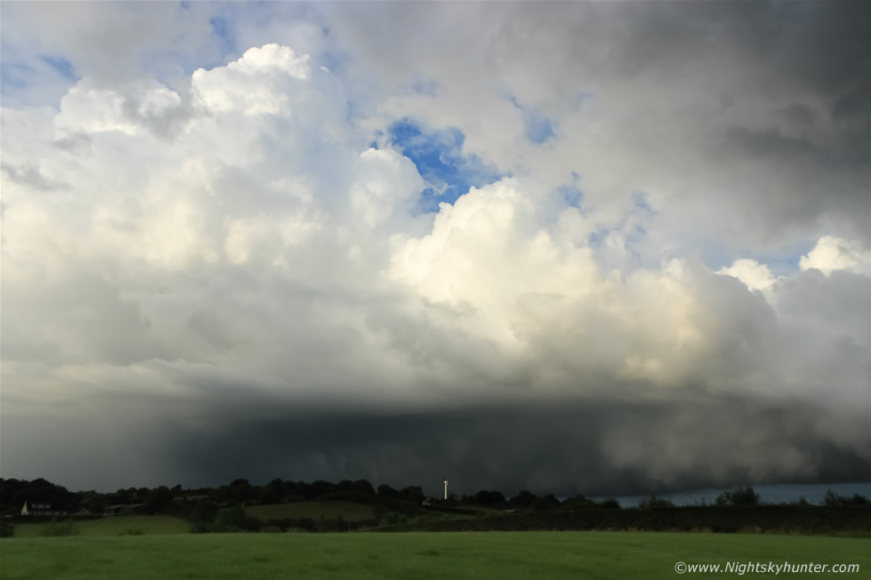
We drove to the N end of town then into the countryside and parked on the roadside with a perfect view towards the W where this linear complex of storms was located. I climbed over a gate into this field and set-up the Go Pro on a tripod and let it record a time lapse, then I got out the DSLR and began shooting stills with the 10mm wide angle lens. This was the NW and N portion of the line, the rest of it extended out of frame to the left and its slow movement allowed me plenty of time to marvel at the evolving clouds and take images at my leisure. Pockets of sunshine filtered through the cloud canopy overhead and lit the field into a wonderful landscape of green which contrasted beautifully with the dark storm clouds aloft.
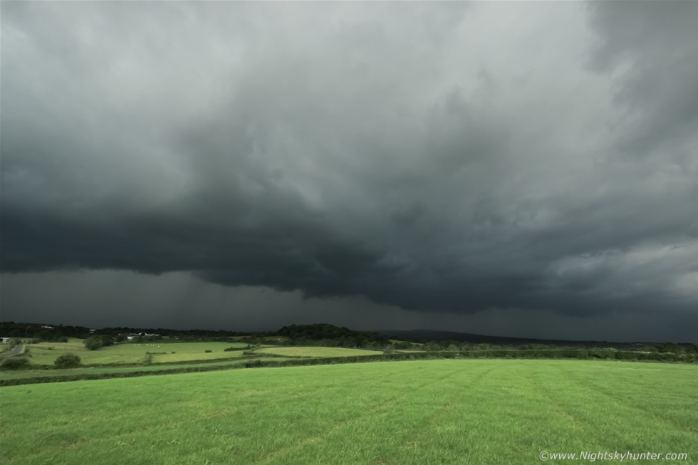 |
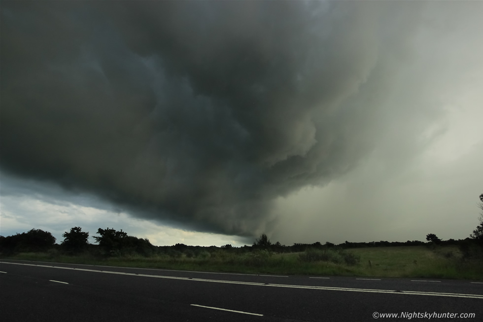
Closer now, I could see sections of black scud ahead of the precip curtain morph and rise as cool outflow air engaged the warm moist air ahead of the storm, the scud solidified into a solid black front lip revealing the presence of a gust front. At this moment in time this line extended all the way from Enniskillen to near the north coast pretty much covering the entire cross section of N. Ireland, radar showed intense cells covering its entire length with strong red and white reflectivity, this was producing massive rainfall amounts while producing a rumble of thunder near Dungannon.
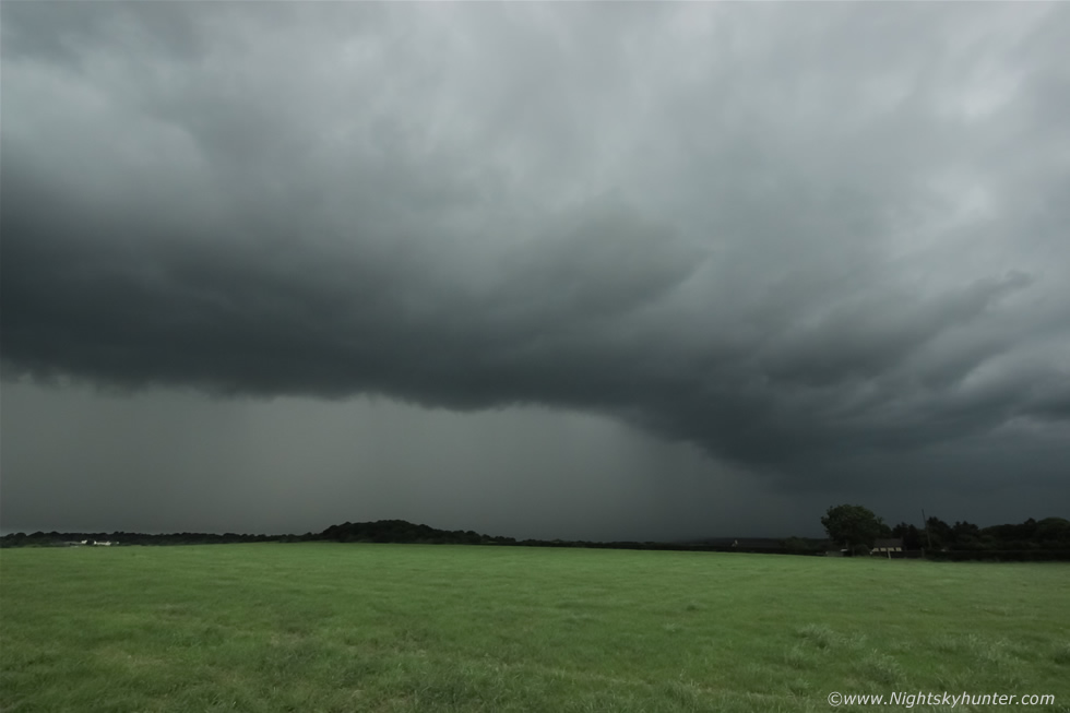 |
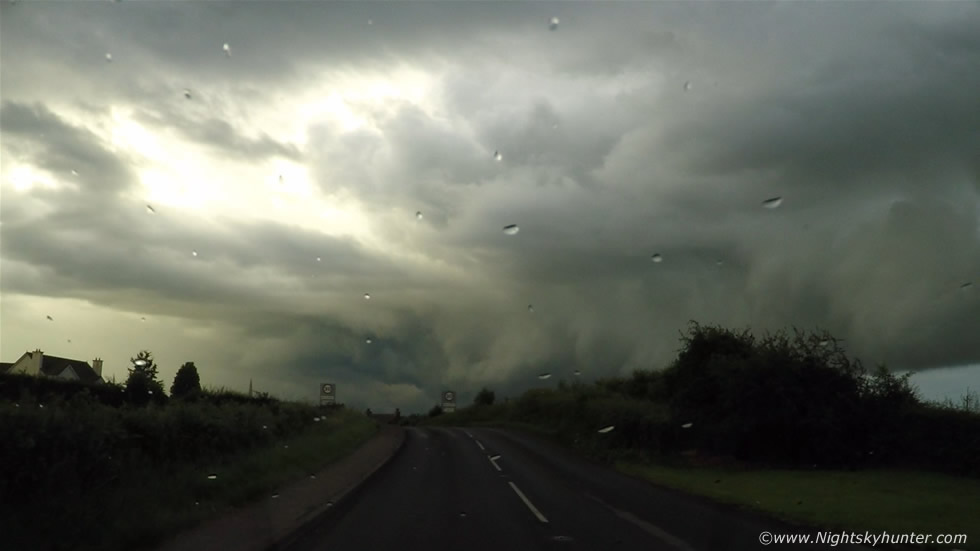
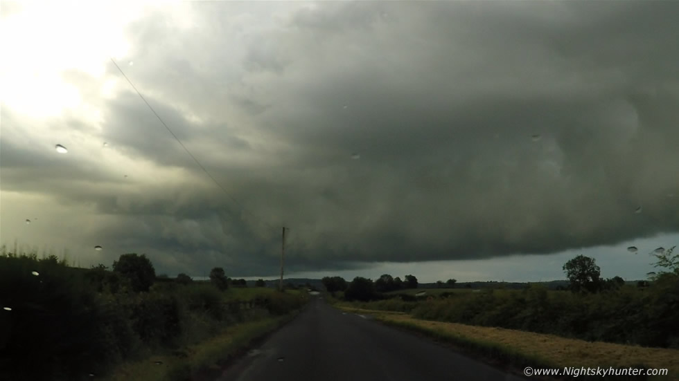
The gust front was almost rite on me and with darkening skies and drops of rain beginning to fall I grabbed the gear and headed back to the van for shelter after which I got pounded by torrential rain for a very long time, the back roads were flooded and by the time I got home and into the house I was soaked rite through. I figured this was probably the event of the day, this storm would likely kill off any solar heating and its outflow hamper any remaining unstable air so I reckoned it was game over for the day so I was happy enough just to get some gust front captures five minutes from home.
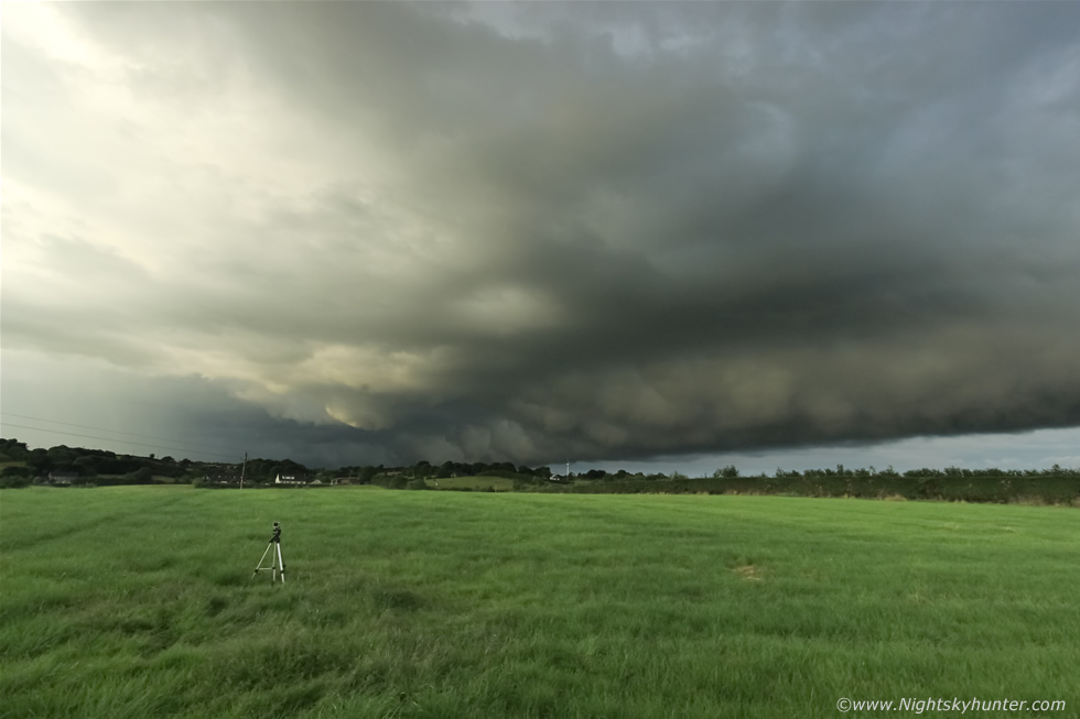
By late afternoon I was out again to chase new cells which appeared on radar moving rite into my area, I relocated back to the same location I had been earlier. This time a herd of Cows were taking a big interest in me and the van, sticking their noses out through the gaps in the gate sniffing me. It was obvious that the atmosphere had completely recovered from the earlier storm and now it felt warm and humid, I could see big towers bubbling up against the W skyline and over the course of the next hour I watched them move in closer and closer from the same field as before while shooting another time lapse with the Go Pro. A low base moved close past me, I examined every detail incase of a funnel or rotation however there was none to be seen however the sky was talking and despite no visible action I had a feeling something was going to break soon so I let the base go and headed back home once more to charge the camera batteries as well as my own, in a word I was starving.
I had dinner and settled down during the evening thinking this day was probably finished this time then after 18.00 I saw an interesting cell on radar near Omagh, this one was arranged in a slanted SW-NE line with strong core at the rear and weak reflectivity in front, in other words this cell was experiencing strong wind shear with the precip being vented to the front, this had my immediate interest because this cell was organised and within the next update it had a large white core on radar, this cell was producing rainfall at the top of scale. By 18.30 that white core was still there yet now the cell had moved over the Sperrins and by 18.45 - it was still there - a white slow moving core going this strong for 45 min's! - I was contemplating chasing yet I still waited a little longer. Then by 19.00 BST I was out in my garden when I heard a distant but angry rumble of thunder break the quiet evening air, a few minutes later there was another, there was no question that this was the same cell I had been watching on radar, I grabbed the gear and ran to the van, I asked my Mum if she wanted to go chasing and she said yes in an instant so we rushed outside and hit the road to the W, I fully expected to be away not much longer than 15 min's however we would end up chasing non stop for the next two hours.
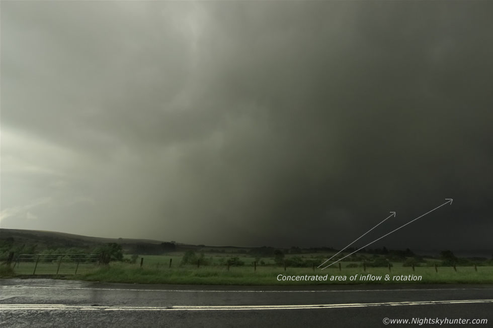 |
The core was already crossing Glenshane Pass and we punched straight into it upon arrival, the rain was torrential, I mean blinding rainfall with wipers at full speed and I still couldn't see well, the road was completely saturated with streams of rain running down the steep road, I reduced speed to avoid hydroplaning then pulled over onto the shoulder to watch the core and rear of the cell drift away to the NE. I instantly observed good inflow motion in the form of scud rising into the base then a good period of rotation in the same area, the base was turning around over the fields yet it was difficult to catch on camera due to the rain still falling on top of us. I drove across to the other side of the road so the front of the van could face the area of interest.
 |
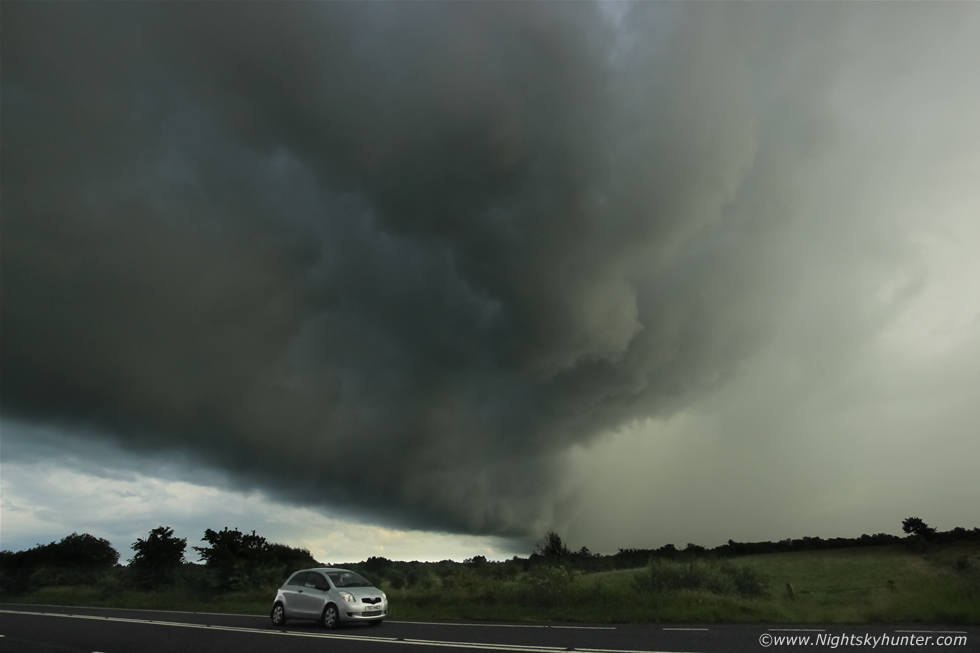
You can just make out the base now through the rain and just how low it was to the ground, cell moving R to L, I could hear more rumbles of thunder deep inside buried in the precip. That lowering of white cloud was where we observed that agitated area of rotation however now it was weakening as the cloud blended in with the rain. Look how much spray was being produced by the passing traffic, rain water was simply flowing down the mountain road, it was unreal how heavy it was yet the drive to the core was completely dry, the transition to this situation was quite astonishing. As the cell moved on clear skies appeared in it's wake and I could see a new line of cells to the SW heading up, these looked fresh and very strong, they had not been on radar earlier so these were new developments which I had not expected so I adopted to the situation and charged S. We punched through another heavy core on the lower Glenshane Road then an awesome scene appeared in front of us, a huge line of updraught bases crossed the road from SW to NE with quite phenomenal structure.
 |
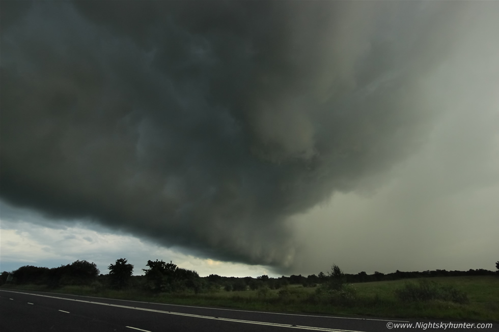
I passed the turn off for Maghera then frantically searched for a position along the road free of tall trees, I found my spot and pulled onto the shoulder on the left side of the road, put down the window and got the DSLR with 10mm lens in action. Rain was still falling but our timing was perfect, this was my first image. I was now getting my meanest storm structure images in the last two or three years, I recalled thinking how this section of the Glenshane Road had always been good to me in the past and here it was producing the goods once more.
 |
Sheared updraught base with cell leaning over to the right with precip falling well away from the inflow area, the clouds were absolutely mean and solid, I was quite blown away to be honest, visually I could see subtle green and blue colours among the dark storm clouds, the entire cell extended well above the 10mm frame and to the left.
 |
These three images have made my entire storm season, this is the kind of thing I like to hunt, for me its the dramatic solid surface based storm clouds that make my chase, when I woke up this morning I never expected to encounter anything like this. It's hard to go back to pulse storms when you have wind shear driven organisation like this. The cell passed straight over us and once the base passed to our left side we observed two areas of tight rotation with cloud and scud spinning in plain view, it looked like it was going to drop one or more funnels over the fields on the E side of the road, then torrential rain hit us hard once again as the core swamped us and I lost visual on the rotation, I had the door open so the entire inside of the door frame and driver's seat was entirely soaked but there was nothing I could do about it, and I didn't care either as I was buzzing from chase.
 |
We punched the core once more and continued S along the Glenshane Road and encountered another cell from the SW from the direction of Slieve Gallion, this cell was younger and still developing yet it still looked very dramatic, 10mm again and moving R to L. Torrential rainfall was drowning the road again saturating everything. Look at the affects of shear once again, the base is over those fields in the distance yet the precip from this cell was falling on top of us now.
 |
Note the strange globular structure along the base, this feature would become a major focus of interest for the next half an hour as the cells grew with greater intensity.
 |
Further S along the same road we found an open gate and drove into this beautiful field, I quickly set the Go Pro out and began recording. The clouds at this point looked astonishing in the high contrast evening light. They looked like a combination of mammatus and whales mouth, yet mammatus form on anvils and whale's mouth are a product of outflow and often seen under gust fronts/shelf clouds. Yet this structure looked a combination of both, you can see undercutting going on yet at the same time this was under the base of a row of updraught towers, I was using the 18-55mm kit lens here near 55mm.
 |
18mm showing the entire base, check out those bizarre globules running along its entire length with grey and blue colours against the green field, cell line was moving R to L and away from me.
 |
Clouds almost touching the trees here, these where slowly moving E and the precip cores up front where rumbling across parts of Ballymena/Ballymoney at this time.
 |
Memory shot with the Go Pro working hard, I should have stepped into the scene but never even though of it at the time. Nice wind swept mid level clouds over the huge globular base.
 |
A clearance appeared in the mid level cloud revealing the top of an updraught tower against the blue sky with a subtle rainbow on show as big isolated drops of rain began falling catching the low evening sunlight.
 |
As the storm departed into the E we watched three big updraught towers erupt above the base, they looked so beautiful in the bright sunshine, crisp and solid, we could see the edges expanding rapidly in real time like a balloon being inflated, this scene was stunning visually however the kit lens doesn't really do it justice, you can see that the base is connected to those towers aloft so all those globules are inflow structure, I don't think I have ever seen structure like it in my life.
 |
We decided to chase it further and head E, the following are stills taken from the Go Pro mounted on the windscreen, this was just before coming into Bellaghy.
 |
Later on the back roads to Newferry, we kept pursing this base incase it dropped a funnel or tornado, it was now late evening and I was shocked to see such dramatic storm clouds at this hour as the sun was getting lower and we would soon be loosing solar heating. We took a back road and came to a dead end near a farm house, back tracked, then made it to Clady and decided to return back N for home. A nice memory was when we pulled into a slanted section of shoulder on the back roads with the van tilted at a 50 degree angle then Mum and I got out and watched the storm clouds move away, a large rainbow appeared against the clouds with base in the field beside us, I didn't take any images but simply enjoyed it visually. The wind was calm, the birds were singing and the fields smelt like Summer, then the sun came out bathing us in its warm light then we happily returned to the van and drove back home under clear skies with the sun setting behind the Sperrins, it had been a fantastic and highly rewarding local chase - I didn't know it then but on the following day a funnel cloud would be spinning in the sky waiting for me to catch!
Time lapse video from the early afternoon period showing the high precipitation convective line with gust front approaching over the fields outside Maghera followed by another time lapse of the late afternoon convection from the same location.
Video documenting the late evening chase from Glenshane Pass, Glenshane Rd and back roads to Bellaghy capturing intense rainfall and the dramatic storm clouds we encountered during various stages of the chase. Thanks very much for reading.
Martin McKenna